Where the Water Waits: The Colne Valley’s Quiet Case Against a Third Runway
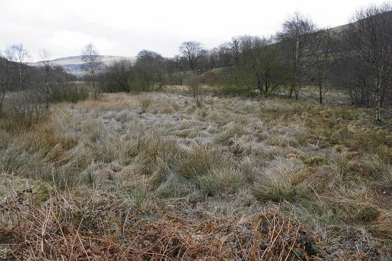
Photo: Bill Boaden , CC BY-SA 2.0, via Wikimedia Commons
The valley is not a backdrop
Heathrow expansion is usually debated as a contest between noise and jobs. That framing is understandable, but it leaves out the landscape to the west of the airport: a low-lying, water-rich corridor that has been managed, dug, drained and re-flooded for generations. The Colne Valley is not empty land waiting for infrastructure. It is a functioning waterscape, and a third runway would not simply add concrete to it. It would rearrange water.
For anyone who lives under the flight path, the water question can feel secondary. It is not. Flood risk, water supply, water quality and habitat protection are the quiet tests that any expansion plan must pass before it can be called deliverable. They deserve the same attention as the noise maps.
What is actually there
The River Colne runs south through west London towards the Thames at Staines. Its tributaries — including the Frays, the Pinn and the Crane — thread through built-up areas and open land, sometimes in culvert, sometimes in channels that still spill into floodplain. The Grand Union Canal crosses the same corridor. Around them sit the gravel pit lakes that give the valley much of its character, together with reservoirs such as King George VI, the Queen Mother and Wraysbury.
This is not a single nature reserve. It is a mosaic: open water, wet grassland, scrub, woodland, marsh, amenity land and working infrastructure. Parts are designated for their importance. The South West London Waterbodies Special Protection Area and Ramsar site cover reservoirs used by overwintering wildfowl. Staines Moor is a Site of Special Scientific Interest. Local wildlife sites and the wider Colne Valley Regional Park fill in the gaps between designations. The airport itself sits on old gravel workings, which is a reminder that this landscape has already been altered — and that further alteration carries cumulative consequences.
The hydrology problem
A third runway would occupy land, change drainage and add impermeable surfaces. In a valley already dependent on careful water management, those are not minor technical details. They are primary planning questions.
Flood risk comes from several directions at once: fluvial flooding from the Colne and its tributaries, surface water flooding where drainage is overwhelmed, and groundwater behaviour in a gravel landscape. Climate change raises the stakes. The UK’s latest climate projections point to wetter winters, more intense rainfall and a greater chance of the kind of sudden downpour that overwhelms drains and spills into roads and gardens. A drainage strategy built on yesterday’s rainfall records is not a strategy; it is a liability.
Water supply matters too. The valley’s reservoirs and underlying aquifer are part of the region’s water system, not decorative lakes. Expansion would increase demand for water during construction and operation, and it could affect abstraction, river flows and water quality. Residents should ask not only whether there is enough water, but who else is competing for it, and what happens to the river when the answer is no.
Water quality is the third leg. Runoff from aprons, fuel storage, de-icing and construction sites can carry pollutants into drains, ditches and watercourses. Sewage capacity is already a live issue across west London. A development of this scale should not be allowed to treat the water environment as a receiving environment of last resort.
The ecology that rarely makes the front page
The Colne Valley’s wetlands support birds, invertebrates, fish, amphibians and mammals that depend on connected water and undisturbed margins. Overwintering wildfowl use the reservoirs. Wet grassland and reedbed support breeding birds. The value of the valley lies in the connections between sites as much as in any single designation.
That creates a specific legal problem for the promoter. Under the UK’s habitats regulations, a plan or project likely to have a significant effect on a protected site must be subject to an appropriate assessment. Mitigation must be considered before compensation, and compensation is not a free pass. You cannot replace a functioning floodplain with a new pond elsewhere and call the account settled. The same logic applies to protected species, to water-dependent habitats and to the cumulative effects of many small losses adding up to a landscape-scale change.
The planning system also has to consider the Water Framework Directive regulations, the National Planning Policy Framework’s flood-risk tests and the development consent regime for nationally significant infrastructure projects. These are not optional extras. They are the statutory hurdles that a development consent order must clear. The problem is that the evidence is usually produced by the applicant. Unless councils and communities interrogate it, the hurdles can become formalities.
The tests residents and councils can demand
A pause is not an obstruction. It is a demand for evidence before commitment. On water and ecology, that means asking for the following in writing, at consultation stage and again at examination:
- A published hydrological baseline for the valley, including river flows, groundwater levels, floodplain storage and drainage pathways, with the models open to independent review.
- A flood-risk assessment that uses current climate-change allowances and shows no net loss of floodplain storage, with compensation measured at least on a like-for-like basis.
- A sequential test that proves the development cannot reasonably be located on land at lower flood risk, together with an exception test that is genuinely exceptional.
- A water cycle study covering construction and operation, including demand, supply, wastewater and water neutrality.
- A habitats regulations assessment that considers cumulative effects and sets out a mitigation hierarchy, not a compensation package bolted on at the end.
- Evidence of compliance with water quality and river basin management requirements, including construction-phase pollution controls.
- A monitoring and adaptive management plan with clear triggers, responsible bodies and enforceable remedies if the predictions turn out to be wrong.
- A cumulative assessment that takes account of other development in the valley, not just the runway footprint.
These are not radical demands. They are the questions a competent applicant should be able to answer. If the answers are not available, that is not a reason to postpone scrutiny. It is a reason to pause the project.
The valley as infrastructure
The Colne Valley is often described as green space. That is true, but incomplete. It is also water infrastructure, flood infrastructure and habitat infrastructure. It performs functions that no amount of airport advertising can replace. A third runway may be presented as a national necessity, but necessity is not a licence to ignore the hydrology and ecology that sit beneath it.
Residents and councils should insist that the water evidence arrives before the political momentum does. The valley has waited a long time for the airport to take it seriously. It can wait a little longer for the truth.